1947-UN-Partition-Plan-1949-Armistice-Comparison
- Blue = area assigned to a Jewish state in the original UN partition plan, and within the 1949 Israel armistice lines.
- Green = area assigned to an Arab state in the original UN partition plan, and controlled by Egypt or Jordan from 1949-1967.
- Light red = area assigned to an Arab state in the original UN partition plan, but within the 1949 Israel armistice lines.
- Magenta = area assigned to the "Corpus Separatum" of Jerusalem/Bethlehem (neither Jewish nor Arab) by the plan, but controlled by Jordan from 1949-1967.
- Greyish = area assigned to the "Corpus Separatum" of Jerusalem/Bethlehem (neither Jewish nor Arab) by the plan, but within the 1949 Israel armistice lines.
Some limitations of the map:
- The small demilitarized zones are not shown. Arabs interpreted these areas as neutral intermediate buffers (like the Neutral Zones between Iraq and Saudi Arabia, or between Kuwait and Saudi Arabia), while Israel interpreted them as full sovereign Israeli national territory under a demilitarization treaty obligation. The conflict between these two interpretations produced frictions which effectively eliminated the special status of most of the zones within a few years.
- A small area at the northeastern corner of the green area on the map -- which would have belonged to the Jewish state according to the original UN partition plan, but which was controlled by Jordan from 1949-1967 -- is not distinguished on the map.
- The Latrun Salient no-man's-land is not shown separately, and the line between green and light red in that area is somewhat fudged. The boundary complications in the Jerusalem area (the Jerusalem no-man's-land, Mount Scopus theoretical enclave, etc.) are too small to show up on a map of this level of detail.
- The map cannot show that the pre-1948 boundaries of the British Palestine Mandate included a ten-meter-wide strip along the northeastern shore of the Sea of Galilee (making it a fully-enclosed British mandate lake), a strip which was overrun by Syria in the fighting of 1948-1949.
Relevantní obrázky
Relevantní články
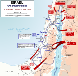
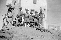
První arabsko-izraelská válkaPrvní arabsko-izraelská válka je první ze série arabsko-izraelských konfliktů, která vypukla po odchodu britských vojsk z Palestiny a vyhlášení samostatného židovského státu 14. května 1948, když na území nově vzniklého státu vpadla vojska jeho arabských sousedů, kteří jasně deklarovali úmysl Izrael zlikvidovat. Válka mezi Izraelem a Jordánskem, Egyptem, Irákem, Libanonem, Sýrií, Jemenem a Saúdskou Arábií skončila postupným uzavřením příměří, s Egyptem 24. února 1949, Libanonem, Jordánskem a Sýrií do konce července 1950. .. pokračovat ve čtení
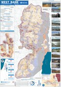
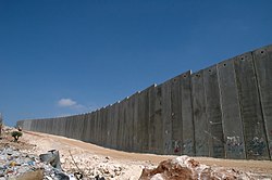
Západní břeh JordánuZápadní břeh Jordánu je označení pro vnitrozemské území na západním (pravém) břehu řeky Jordán na Blízkém východě. Na východě je území vymezeno řekou Jordán a Mrtvým mořem, ze zbylých stran hranici tvoří tzv. zelená linie s Izraelem. Mezinárodním společenstvím je území většinově uznáváno jako součást státu Palestina. .. pokračovat ve čtení
Plán OSN na rozdělení PalestinyPlán OSN na rozdělení Palestiny je plán Organizace spojených národů na řešení židovsko-arabského konfliktu na území Britského mandátu Palestina z roku 1947, podle kterého měly na jeho území vzniknout dva nezávislé státy, židovský a arabský, a Jeruzalém a okolí měl zůstat pod mezinárodním dohledem. .. pokračovat ve čtení
Dohody o příměří (1949)Dohody o příměří z roku 1949 jsou sérií dohod podepsaných v roce 1949 mezi Izraelem a jeho sousedy: Egyptem, Libanonem, Jordánskem a Sýrií. Dohody ukončily oficiální nepřátelství – První arabsko-izraelskou válku a stanovily linie příměří mezi Izraelem a Západním břehem, které byly až do Šestidenní války v roce 1967 známé jako Zelená linie. .. pokračovat ve čtení


