Gamkonora
| This file is in the public domain in Indonesia, because it is published and distributed by the Government of Republic of Indonesia, according to Article 43 of Law 28 of 2014 on copyrights.
Any of the following acts are not considered Copyright infringement:
|
 |
Relevantní obrázky
















Relevantní články
GamkonoraGamkonora je sopka v severní části indonéského ostrova Halmahera. S výškou 1 635 m je jeho nejvyšší bod. Vrchol vulkánu tvoří skupina kráterů, seřazených v linii severozápad–jihovýchod. Gamkonora je poměrně aktivní, jelikož od 16. století bylo zaznamenáno přibližně tucet, zpravidla menších explozivních erupcí. Největší se odehrála v květnu 1673 a její síla dosahovala VEI 5. Vyvržený objem sopečných produktů činil zhruba jednu miliardu m³ a katastrofu doprovázela ještě vlna tsunami, která zničila pobřežní vesnice. Poslední výbuch proběhl v červenci 2007 a donutil 8 tisíc lidí se evakuovat. .. pokračovat ve čtení
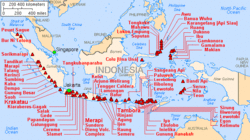
Seznam sopek IndonésieToto je seznam sopek v Indonésii. .. pokračovat ve čtení
