Indonesia - Sangeang Api
Autor:
NASA
Shortlink:
Zdroj:
Formát:
2016 x 1856 Pixel (816058 Bytes)
Popis:
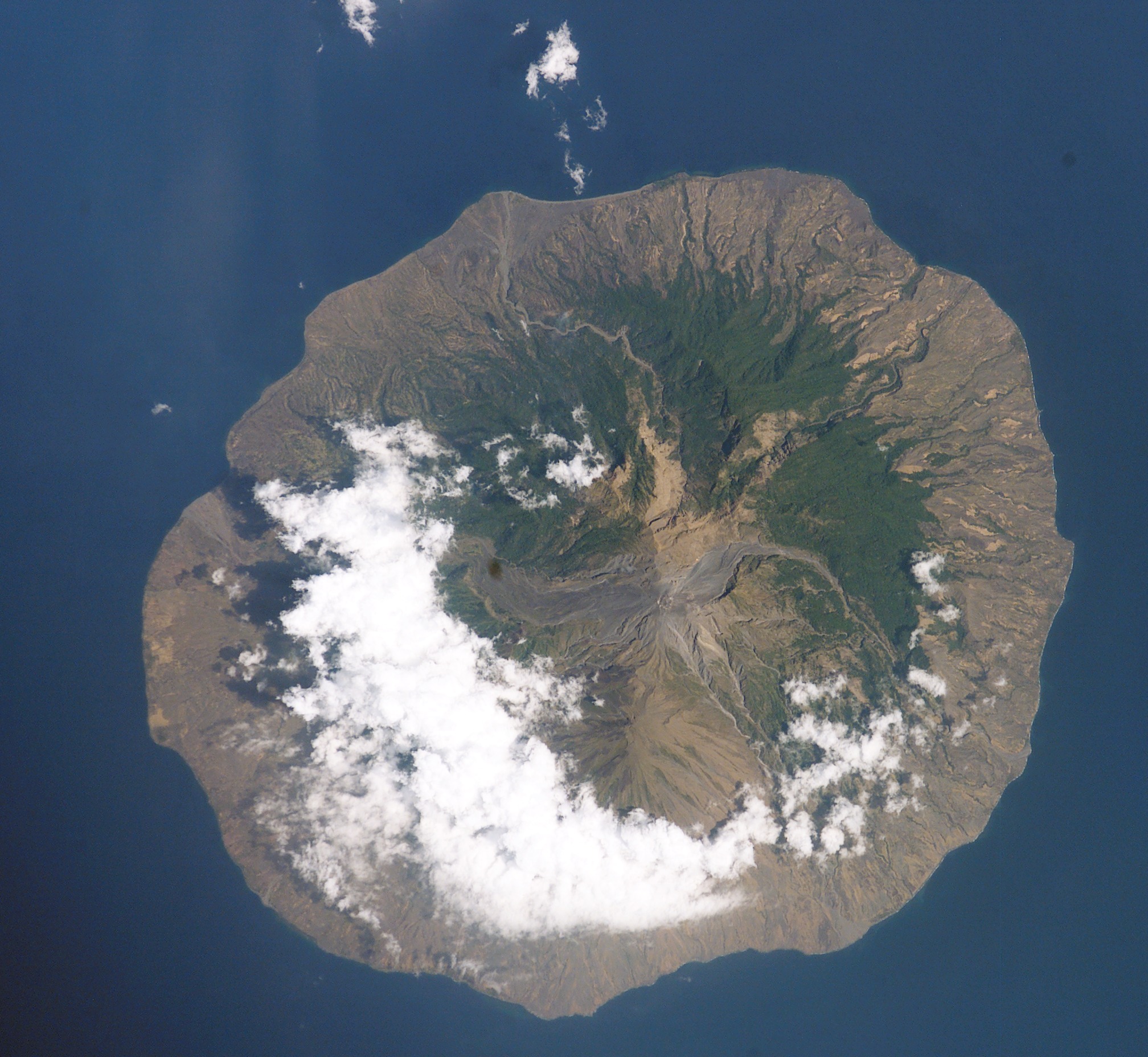
Sangeang Api Island, Indonesia
- In 1985, the small Indonesian island of Sangeang Api (for scale, the island is 13 km wide) off the northeast coast of Sumbawa began to erupt. Within a month, the 1250 inhabitants had evacuated to Sumbawa. The eruption lasted until 1988. The lava and pyroclastic flows—the wide channel running west from the summit—are still easily traced on this image taken last week by Space Shuttle astronauts (STS-112) . Today, the island's summit crater (1949 m) produces intermittent steam clouds.
Licence:
Public domain
Credit:
Sdílet obrázek:


Relevantní obrázky


Relevantní články
Sangeang ApiSangeang Api je činný vulkanický komplex, nacházející se na indonéském ostrově Sangeang. Ten je široký 13 km a jeho rozloha činný 153 km². Sopka patří mezi nejaktivnější v souostroví Malé Sundy a tvoří ji převážně latit a čedič. Skládá se dvou sopečných center: Doro Api a Doro Mantoi. Obě dvě spočívají na východním okraji starší kaldery. K poslední erupci došlo v únoru 2022. .. pokračovat ve čtení