Santa monica mountains canyon
Autor:
Původně soubor načetl Geographer na projektu Wikipedie v jazyce angličtina
Přisuzování:
Obrázek je označen jako „Vyžadováno uvedení zdroje“ (Attribution Required), ale nebyly uvedeny žádné informace o přiřazení. Při použití šablony MediaWiki pro licence CC-BY byl pravděpodobně parametr atribuce vynechán. Autoři zde mohou najít příklad pro správné použití šablon.
Shortlink:
Zdroj:
Formát:
1224 x 1632 Pixel (1071210 Bytes)
Popis:
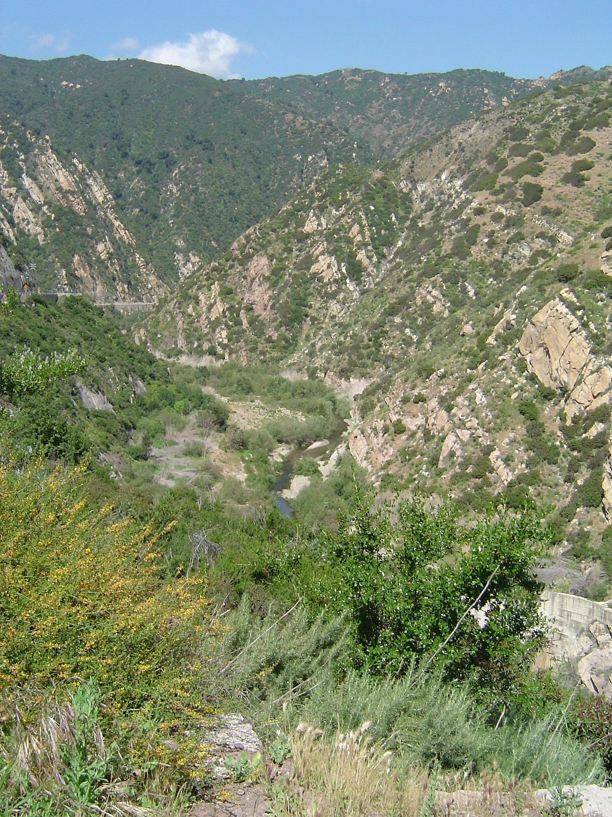
Malibu Canyon — looking north (upstream), in Malibu Creek State Park, Los Angeles County, California.
- Malibu Creek formed the canyon as it eroded through sedimentary layers as they were tilted upward to form the Santa Monica Mountains and thus it is older than the range itself. The Rindge Dam is visible at lower right, partly hidden by a Ceanothus bush. The dam was built by the owners of the Malibu Ranch (present day Malibu) in the early 20th century. It is now full of silt and serves no purpose while blocking the runs of endangered steelhead trout and is presently slated for removal.
- The common chaparral plants in the foreground are gray fine-leaved California sagebrush (Artemisia californica), and colorful Deerweed, (Lotus scoparius). This canyon burned in a brush fire in 1993, ten years prior to the photograph.
- Credits
Photographed and uploaded by user:Geographer.
- Taken April 26, 2003.
Licence:
Credit:
Sdílet obrázek:


Relevantní obrázky


Relevantní články
Pohoří Santa MonicaSanta Monica je pobřežní pohoří v jižní Kalifornii. Pohoří je dlouhé přibližně 64 km a táhne se od Hollywood Hills ve městě Los Angeles až po Point Mugu v okresu Ventura County. Nejvyšším vrcholem je Sandstone Peak s 948 m n. m. Jelikož je pohoří relativně obydlené, je oblíbenou turistickou destinací. .. pokračovat ve čtení