angličtina: Bird's-eye view of Amsterdam 
angličtina:
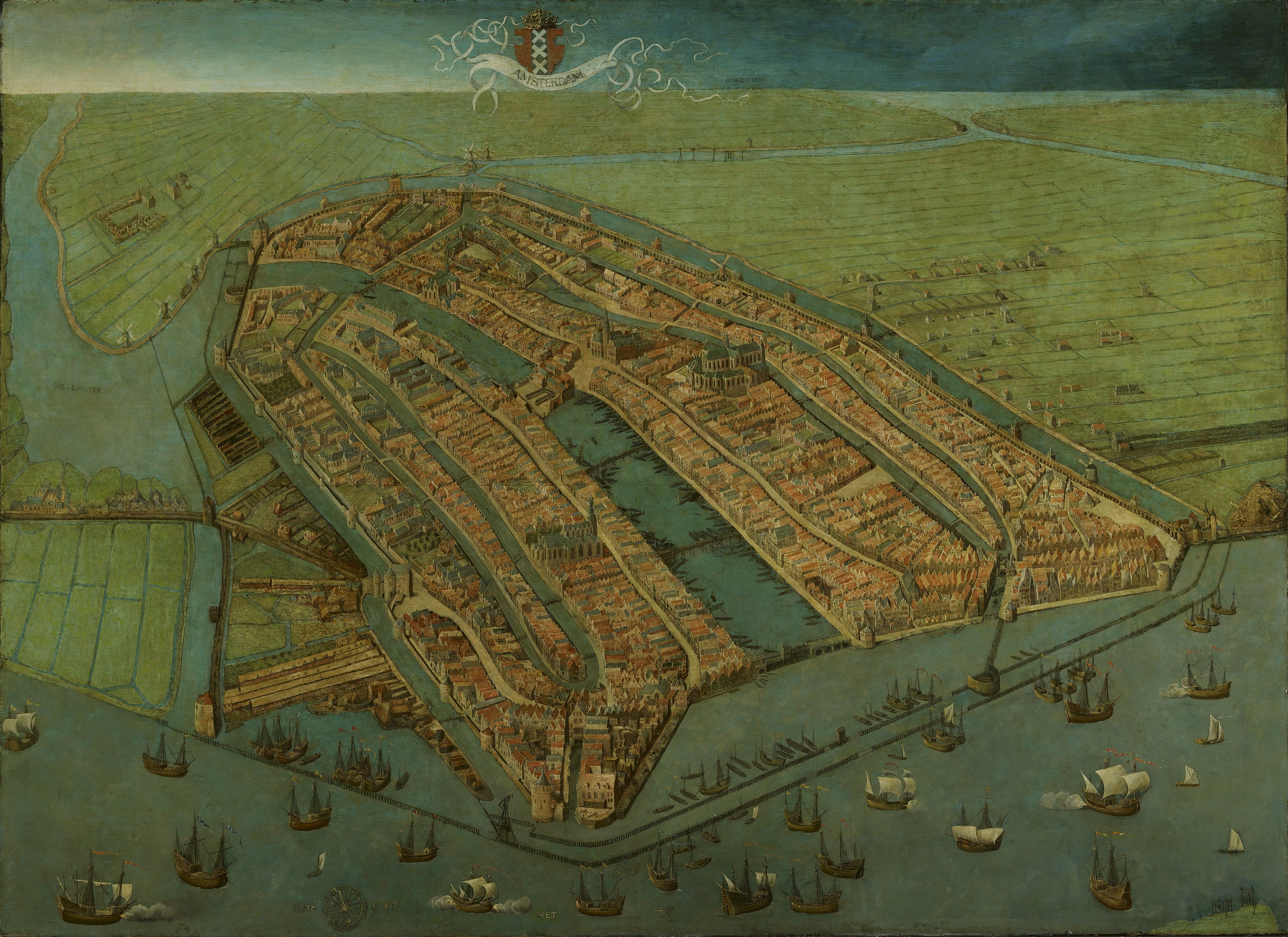
Bird's-eye view of Amsterdam
Autor:
Shortlink:
Zdroj:
Formát:
3341 x 2431 Pixel (3332871 Bytes)
Popis:
Oldest surviving map of Amsterdam, showing the city's finished medieval walls, towers and gates. Like in most old maps of Amsterdam the city is shown from the IJ, so that the view is directed to the south rather than the north.
Licence:
Public domain
Sdílet obrázek:


Relevantní obrázky

_by_Cornelis_Anthonisz.jpg)
.jpg)
Relevantní články
Cornelis Anthonisz.Cornelis Anthonisz. byl holandský malíř, rytec, kartograf a leptař. .. pokračovat ve čtení